Development of AI-based technology for road network extraction from CS 3D maps
Ministry of Agriculture, Forestry and Fisheries Research and Development for Climate Change Response in Agriculture, Forestry and Fisheries
Northern System Service has developed an AI-based technology for extracting road networks from CS 3D maps. Conventionally, forest roads were not fully covered by topographic maps, and the creation of accurate maps took an enormous amount of manpower and time. To solve this problem, we developed a system that uses Deep Learning to extract the road network of forest roads by using AI to extract past collapse sites and fragile slopes from topographical data.
This technology is being used to build a system for sharing forestry infrastructure information and to research forest roads that can function as detour routes in the event of a disaster. In addition, we have recently received many requests for "measurement" from major surveying companies.
Background
In recent years, the increase in torrential rains has resulted in a series of slope failures across Japan. Systems have been developed to predict disaster risks in advance and to respond quickly after disasters. With support from the Cabinet Office, the project involved the Ministry of Agriculture, Forestry and Fisheries, prefectural forestry-related organizations, universities, companies involved in aerial lightweighting, and other system development companies such as our company and Northern System Service Co.
Flood damage caused by torrential rain in July 2020: Geospatial Information Authority of Japan website

Landslide disaster caused by torrential rain in July 2020

The project aimed to create new private businesses and improve the disaster preparedness of mountainous areas through the development of highly accurate disaster risk detection and extraction technology using various spatial data and AI possessed by governments and other organizations, and the establishment of a system for sharing and utilizing information on forest roads and other mountainous infrastructure.
Based on this goal, efforts were made to use AI to extract sites of past collapses and fragile slopes from topographic data and to extract forest road networks. The forest road network extraction is an attempt to easily visualize forest roads, which are not only important as forestry infrastructure but can also be used as detour routes in the event of a disaster. In the past, forest roads were not fully covered by topographic maps, and maps owned by forest managers were time-consuming and labor-intensive to update, so an automatic extraction technology for vector road network data was sought.
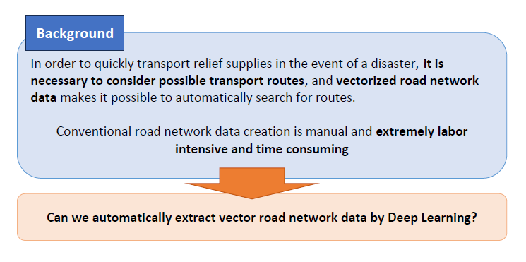
Image credits
- Flood damage caused by torrential rain in July 2020:Geospatial Information Authority of Japan Website(https://www.gsi.go.jp/BOUSAI/R2_kyusyu_heavyrain_jul.html)
- Landslide disaster caused by torrential rain in July 2020:Ministry of Land, Infrastructure, Transport and Tourism(https://www.mlit.go.jp/river/sabo/jirei/r2dosha/r2_07gouu.html)
road network extraction by Deep Learning
Since Deep Learning has been actively researching the detection of objects in images, we verified whether it is possible to detect road networks from images, and aimed to realize automatic path finding using vectorized road network data.
General Object Detection

Road Extraction from Satellite Images

Image credits
- General Object Detection:GitHub - matterport/Mask_RCNN:Mask R-CNN for object detection and instance segmentation on Keras and TensorFlow(https://github.com/matterport/Mask_RCNN)
- Road Extraction from Satellite Images:GitHub - CosmiQ/basiss: Broad Area Satellite Imagery Semantic Segmentation(https://github.com/CosmiQ/basiss)
About AI-based road network extraction technology
1. What is AI-based road network extraction technology?
The key to easily and automatically extracting the latest forest road network was the map data of the forest road network digitized by Gifu Prefecture after each forest road was driven. The AI learns the criteria for distinguishing forest roads by comparing the actual road network data with the CS 3D map, so that only forest roads can be extracted.
2. The Power of AI×road network extraction Technology
Here is an image of the road network extracted by AI using the CS 3D map of Gifu Prefecture and the road network data. The extracted road network is the green line, and the dotted line is the actual road network. As you can see, the AI was able to extract the road network with very high accuracy.
Input image (Gifu Prefecture)

Output results (Green: Extraction results Dotted line: Correct data)

When we loaded CS 3D maps of Nagano and Fukuoka into the AI, which was able to distinguish forest roads in Gifu Prefecture through learning, it was able to extract them with high accuracy. It was found that the "Gifu standard" training data could be applied to other regions of Japan as well.
Input image (Nagano Prefecture)

Output results (Pink: Extraction results Dotted line: Correct data)

During the presentation of the project's results, government officials in charge of forest road network extraction commented that the process "used to take three years" and "is more accurate than human work," raising expectations for increased efficiency in management operations.
3. Deployment of road network extraction Technology
Forest road networks are also attracting attention from universities. The Forest Production Engineering Laboratory of the Faculty of Agriculture at Iwate University, where Dr. Hitoshi Saito, who was also involved in this project, belongs, has been conducting research to verify the functionality of forest roads as detour routes in times of disaster. In the future, it is expected that the easy extraction of forest road networks will make it easier to conduct research to explore the potential of forest roads.
The project also created a new business of extracting road networks from topographic data created by aerial laser survey, such as CS 3D maps, based on the learned data. It can be expected that the extraction process, which used to take a lot of time and effort by the government, will be replaced by a form of outsourcing to the private sector.
Highly accurate geographic data held by the government is processed and extracted by private companies that have the know-how to utilize the data. The data is also used for research at universities. The results produced through industry-academia-government collaboration will contribute greatly to forest planning and emergency disaster response in the future.
4. At the end.
This research was supported by the "Research and Development for Climate Change Response in Agriculture, Forestry and Fisheries" project funded by the Ministry of Agriculture, Forestry and Fisheries of Japan, and by the Public-Private R&D Investment Scaling Up Program (PRISM) of the Cabinet Office.
Contact
Please feel free to contact us for system development consultation, system construction quotes, and employment questions.